
On the plot what’s on the official map Beta
Land change detector using satellite images.
- Vegetation loss
- New water or flooding
- Burnt area
- Earthworks and bare soil
- New hard surface
Foral Terra · Watch a plot
Fire, storms, council decisions, PDM changes: we tell you when something touches your plot — in plain language.
See how it worksSee an example with real dataWant to see the local rules first? Explore a plot for free
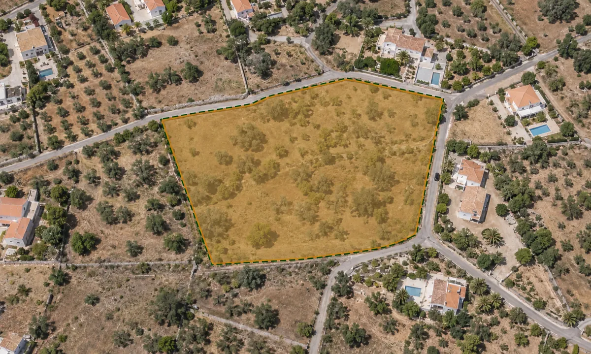 “Grandma’s plot” · Lagos
Very high fire risk in the area
Public consultation on a nearby subdivision
Made for
You live outside Portugal
You inherited a plot
You have woodland or scrub
You want to buy or invest
Point on the map or type in the coordinates. Give it a name you’ll recognise. No documents needed.
We check official sources for the plot’s area — some daily, some weekly.
In your monitoring space — and by email if it’s urgent: what happened, what it means and what you can do.
What we watch
We watch four distances. The closer to the plot, the more certain we are — and every alert tells you how far away it happened.
Land change detector using satellite images.
Weather, risk and events around the plot.
What the council publishes and decides.
National rules that may apply to your plot.
Not every municipality publishes the same information. Your monitoring space shows what’s active for your plot — and when we’re not sure, we say so.
Availability varies by municipality, source and confirmed footprint. Collection frequency is separate from publication and alert frequency.
For buyers, builders, remote owners, woodland owners and farmers: one plot at a time, with an evidence history and contextual alerts.
Publication, revision and amendment of PDM and other territorial management instruments.
Procedures to prepare or amend territorial plans, including public participation stages when published.
Published plan deadlines and regulatory transition dates, with the known scope for the watched area.
Publication and amendment of municipal regulations on urbanisation, building and fees.
Council minutes, notices and other municipal publications relevant to the plot area; each alert explains the actual relation.
Official publications about charges or encumbrances in the area; a plot relation is stated only when documented.
Fire risk, weather warnings and forecast, earthquakes, thermal anomalies and scheduled power cuts, where sources cover the location.
Notices about duties and deadlines potentially relevant to the area or declared plot use, subject to individual confirmation.
Updates to official national maps — REN, RAN, Natura 2000, easements and other constraints.
Changes to municipal zoning and constraint maps, including land use classes and building indices.
Updates to ICNF and DGT map data where available. We verify whether an edition changes the plot before claiming impact.
Corrections identified in geographic or regulatory sources; we relate them to the plot only when location is confirmed.
Compares satellite images of the plot to detect changes on the surface: vegetation loss, new water, burnt area, earthworks and new hard surface. The cause is not confirmed.
Relevant OpenStreetMap edits within 500 metres of the watched point.
Articles from local and national press about the municipality and the plot surroundings.
Listings and market indicators nearby where comparable data exists. Context, not a change to the plot.
Each alert should identify its source, publication or validity date, locality and relation to the plot. A municipality mention or broad map refresh may need verification before claiming parcel impact. Land-change detection uses Sentinel-2 satellite imagery and the NASA OPERA DIST-ALERT product.
Alert examples
Six examples, six different types. Pick one to read. By email we only send urgent alerts and the weekly summary.
“Plot” · Arouca, Aveiro
“Quinta do Monte” · Silves, Faro
“Grandma’s plot” · Lagos, Faro
“Dad’s garden” · Lagos, Faro
“Luz plot” · Lagos, Faro
“Grandma’s plot” · Lagos, Faro
Illustrative examples (September 2026), some based on real Watch a plot alerts and real official notices. We changed the plot names and simplified some sentences. By email we only send urgent alerts and the weekly summary; the rest stay in your monitoring space.
A real case
A public case in a municipality with watched plots. The dates come from the official sources below.
4 Aug 2026
At a council meeting, Arouca council took the decision that led to the public consultation on the 1st amendment to the 2nd revision of the municipal master plan (PDM).
17 Aug 2026
Notice no. 20360/2026/2 was published in the Diário da República.
24 Aug to 2 Oct 2026
The public consultation on the change to the PDM took place.
25 Sep 2026
Watch a plot linked the PCGT record to the council page: the same notice, with the same dates.
The notice is for the whole municipality. We have not yet checked if the change touches each plot. A notice that was already open when the plot was registered does not cause an email: it stays in the monitoring space.
Sources (checked on 25 September 2026)
The most important changes aren’t always visible on site. Drag to compare.
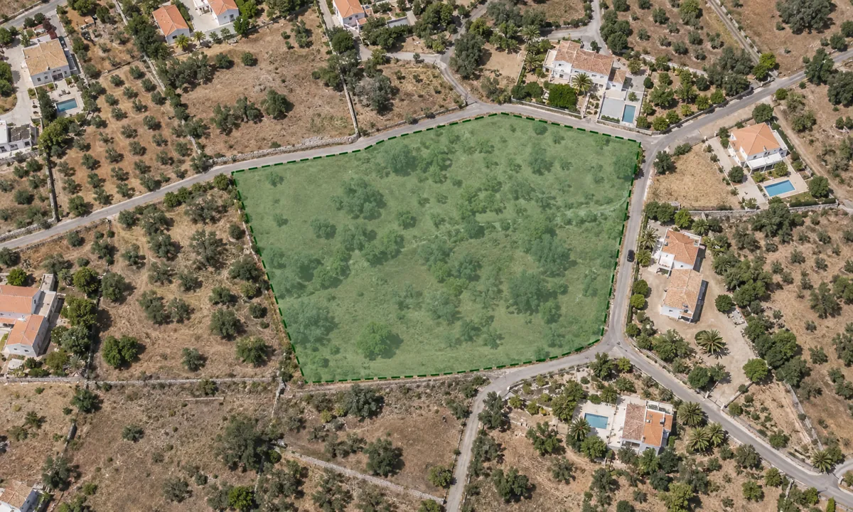
We only state a change like this once the official plan edition, its applicable date and a confirmed plot boundary support it.
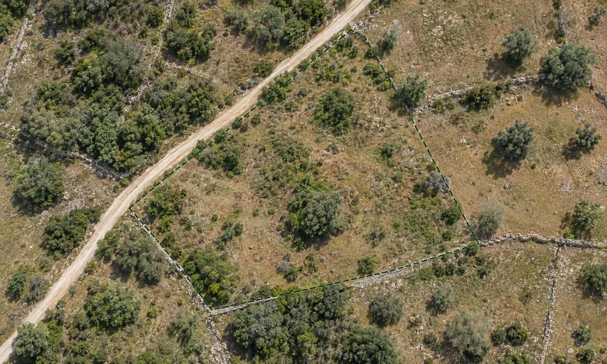
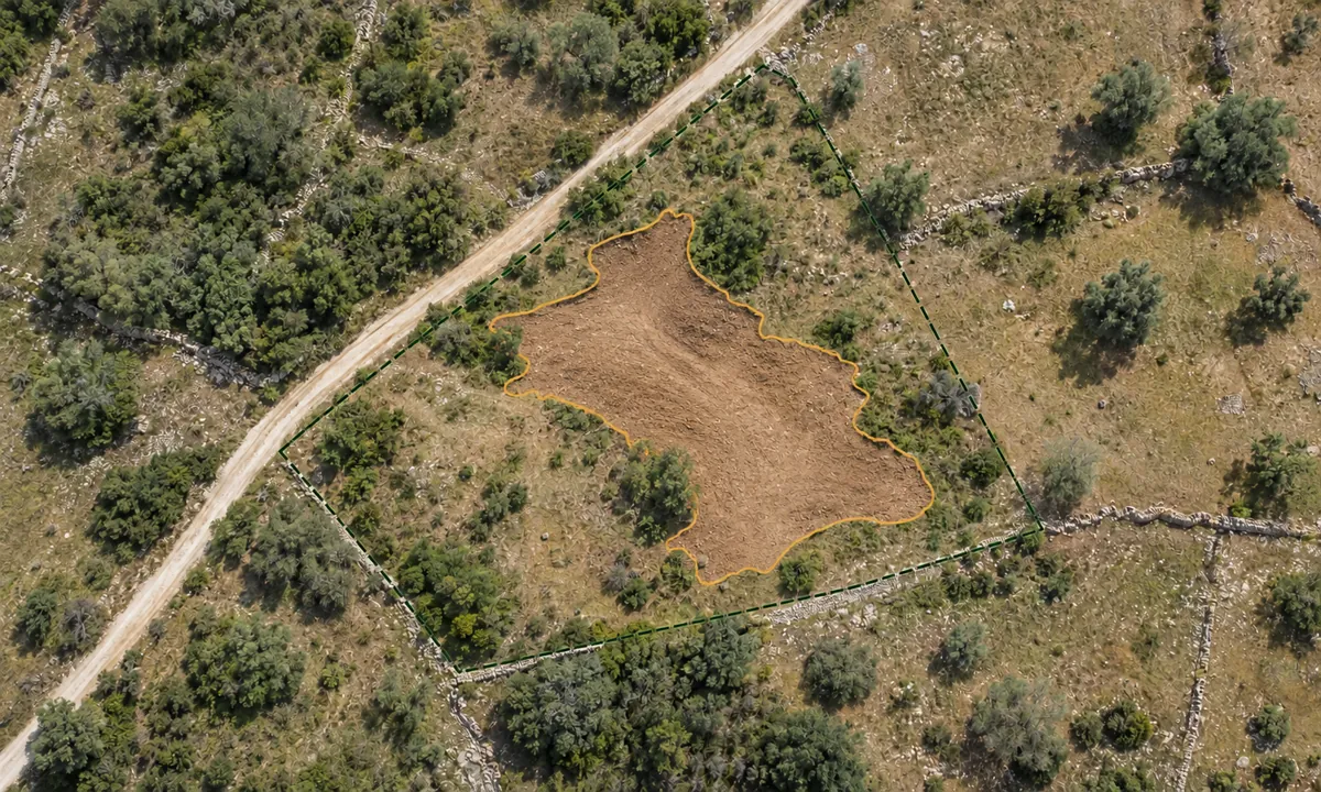
Satellite image comparison. It shows that something changed on the surface, but not why.
Mark the plot on the map and follow the alerts in your monitoring space, wherever you are. Urgent ones, like very high fire risk, also reach you by email. You don’t need to visit the site or call the council to find out if anything changed. Each alert explains what happened, what it means for your plot and where the information comes from. You can also get a weekly summary, even in quiet weeks.
We follow the rural fire risk published by IPMA (the Portuguese Institute for Sea and Atmosphere) for the plot’s area. When the risk rises to “Very high” or “Maximum”, we warn you and say what you can do — for example, not burning vegetation. We also warn you when the risk stays high for several days in a row and when there are severe weather warnings, like strong wind.
The PDM (Municipal Master Plan) is the council’s plan that sets out what can be built and done in each zone of the municipality. We warn you when a plan is published, amended or revised, and when a public consultation period opens. We only say a change touches your plot when we can confirm it on the official map. When we can’t, we say so clearly in the alert.
It detects surface changes with satellite images: vegetation loss, new water, burnt area, earthworks and new hard surface. The types are estimated by rules and the cause is not confirmed. This feature is in Beta.
Start by marking the plot on the map, even if you don’t yet know its exact boundaries. You’ll start receiving alerts about fire risk, plans and council decisions for that area. If you confirm the plot’s area, the alerts become more precise.
It can help. While you decide, you’ll know if the council has opened public consultations, if nearby subdivisions are changing, or if plans are being revised. Alerts don’t replace consulting the council, the land registry certificate or a professional’s advice.
On high fire-risk days, alerts remind you what to do, such as keeping fuel-management strips clear. Notices about legal clearing deadlines are not yet available for every municipality. Where they exist for your area, they appear in your monitoring space.
Watch a plot is part of Foral’s Premium plan. You can start for free with Explore a plot and activate monitoring whenever you want.
They work in mainland Portugal. What we can watch varies by municipality, because not every council publishes the same information. Your monitoring space shows what’s active for your plot.
Only when something relevant happens for the plot’s area. Some sources are checked every day, others every week. By email we only send urgent alerts, such as fire risk or severe weather warnings, plus a weekly summary; the rest stay in your monitoring space.
Watch a plot is part of Foral’s Premium plan. You can start for free with Explore a plot.